For fellow lovers of historical maps:
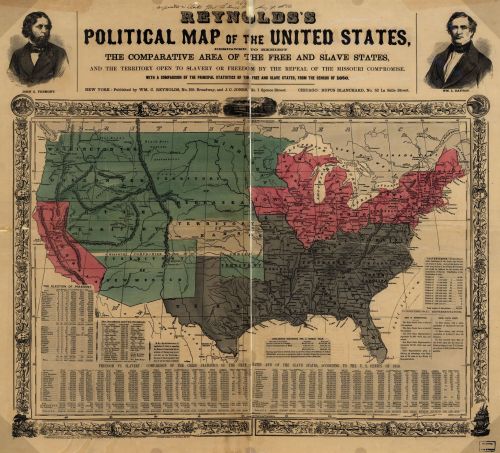
"Designed to exhibit the comparative area of the free and slave states and the territory open to slavery or freedom by the repeal of the Missouri Compromise (wiki) with a comparison of the principal statistics of the free and slave states, from the census of 1850."
"Designed to exhibit the comparative area of the free and slave states and the territory open to slavery or freedom by the repeal of the Missouri Compromise (wiki) with a comparison of the principal statistics of the free and slave states, from the census of 1850."
Click here to embiggen.
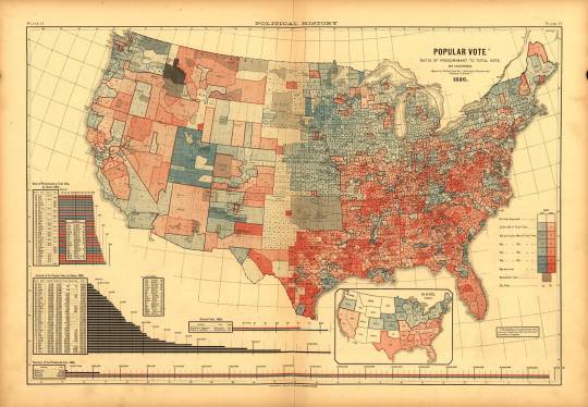
And this one is a map of the popular vote from 1880 (embiggen here):
Related:
From 1803, The Ottoman Empire's First Map of the Newly Minted United States.
No comments:
Post a Comment